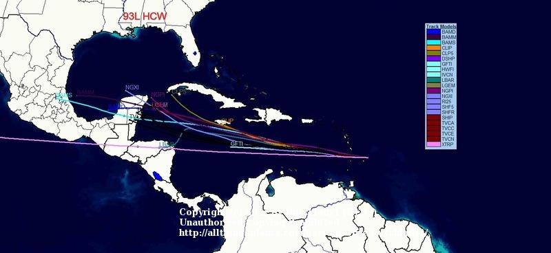
It doesn't look like invest 93L is going to give us any trouble, here the latest picture:
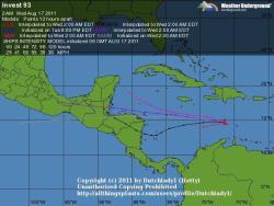
However, this is a status update on a new system that is forming that could cause us folks in Florida some trouble. I quote it (from Crown Weather) in its entirety.
Tropical Disturbance In The Eastern Atlantic:
I am closely watching a tropical disturbance that is located in the eastern Atlantic near 30 West Longitude. Currently, water vapor imagery showed that dry air is being pulled into this disturbance and this should put a hold on any development for the time being. This is not good news as this means this disturbance will be able to track further to the west and develop much further west and be a potential threat to the Caribbean and the US coast.
The global model guidance as a whole continues to insist that this tropical disturbance will eventually develop into a tropical cyclone early next week. Please note that all of the models wait to develop it until it is west of 55 or 60 West Longitude.
The latest GFS model forecasts that this system will start developing on Saturday when it is just east of Barbados. The GFS model then forecasts this system to track across the eastern Caribbean to the south of Puerto Rico and strengthen this weekend into early next week before tracking across the northern Caribbean and across central Cuba next Thursday. The GFS model ultimately forecasts this system to track into the eastern Gulf of Mexico next Friday and Saturday and makes landfall as a hurricane on the Florida Panhandle next Saturday night.
The Canadian model forecasts this to be located just offshore of the east coast of Florida by next Friday as a hurricane.
The European model forecasts that this disturbance will wait to develop until Monday when it is approaching the Turks and Caicos islands. The European model ultimately forecasts this to be a strengthening tropical cyclone over the northern Bahamas next Friday.
Ok, let’s take a step back and look at this disturbance realistically. It is notable that we continue to have agreement and consistency among the models that a significant tropical cyclone will develop west of 60 West Longitude next week. As of this morning, this disturbance is battling dry air and water vapor imagery indicates that we should continue to see it battle dry air right up to at least 50 West Longitude. Also, these same models were forecasting late last week that Invest 93L was going to be a significant tropical cyclone and well we don’t have that. I think it is reasonable to say that we should just keep an eye on this disturbance and see how much the dry air takes a toll on this disturbance and not get worried over the big hurricanes that the model guidance have been forecasting for next week. I think that by Friday when this disturbance is west of 50 and 55 West Longitude, we should start seeing whether we may have a real problem on our hands or if the model guidance forecasts were wrong.
So, I think that this disturbance will continue tracking westward for the next several days and track across Barbados and the Windward and southern Leeward Islands on Saturday into early Sunday. I think the European model may be way too far north in its forecast and that this disturbance is headed for the Caribbean. I also think that the GFS model is being too aggressive in its intensity forecast this weekend and that development will be slower to occur as this disturbance works out the dry air as it reaches the Lesser Antilles and the eastern Caribbean. If we are to have development into a tropical depression or a tropical storm, it will probably wait until Sunday or Monday when it is in the eastern part of the Caribbean.
So, for now, this is a disturbance that I will be monitoring closely over the next several days needs to be watched very closely. Finally, I want to mention that the overall pattern during the 8 to 10 day timeframe continues to point to that anything that does track into the Caribbean would be potentially steered northward towards the Florida Peninsula. So, vigilance is the word of the day here.