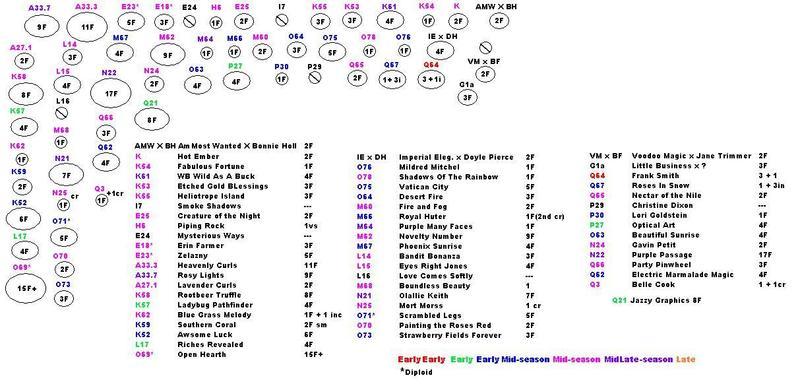
I then used Microsoft Paint to make the map on the computer. I used color coding to indicate the season of bloom for each plant. A number-letter designation has been assigned to each plant. The letter indicates scape height. The number helps me keep track of how many of that height I have. They started out in alphabetical order, but as I received more plants and added more designations, that fell by the wayside since I did not want to renumber each time new plants were added.
I also use the Plantstep Flower program to help keep track of my plants. The program has a location feature that is helpful, but has some drawbacks. It is set up to use a grid type system which does not lend itself well to beds planted in a more free-form manner.