"I was under the impression that the glaciers leveled the land they covered. "
Yes, the escarpment is the line where the glacier stopped. The park is in unglaciated land. No doubt there were already streams and valleys that were wildly changed by glacial melt. TY for helping things to be more specific.

(Just wish someone had proofread. Due, not do (at the bottom.)
If approaching from the north, it's flat as a pancake, then all of a sudden, there's a line of hills.
http://www.uky.edu/OtherOrgs/K...
 http://www.ohiohistorycentral....
It runs northward, toward Cleveland area.
http://www.nps.gov/cuva/planyo...
It's fascinating stuff, if personally interesting.
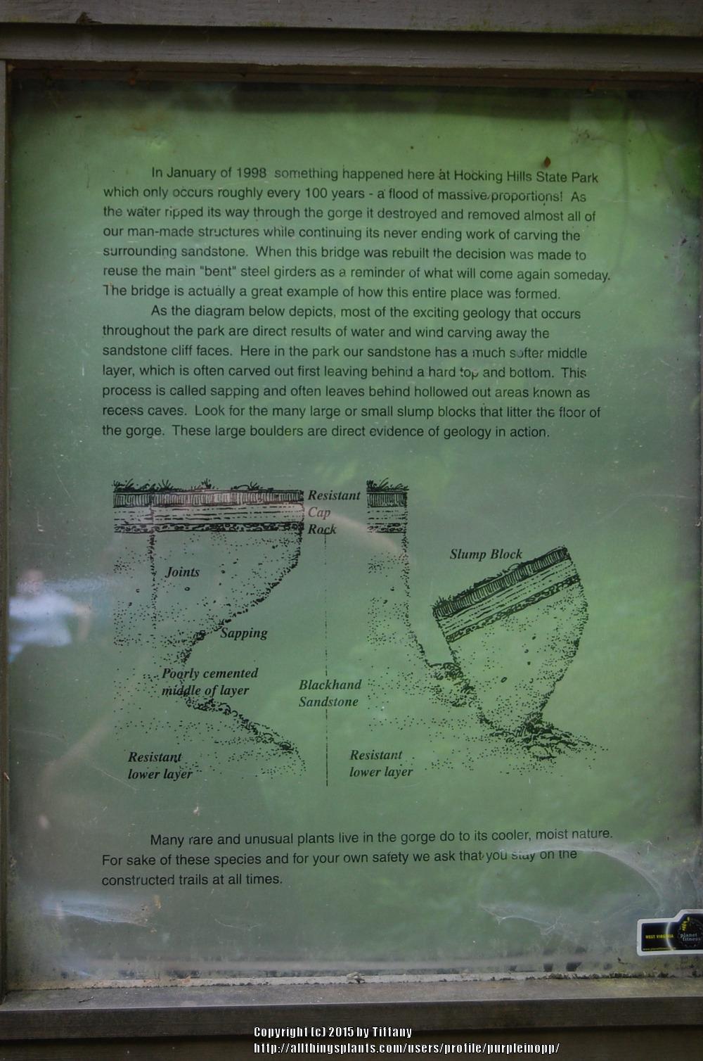
"Strangest of all was the division line between these two areas. It was as if the roughly square-shaped state of Ohio had been folded diagonally from the northeast to the southwest corners, and half the state had received the same erosion as the Allegheny-Appalachian highland. The other half, however, had been worn smooth into what scholars call the Erie Plain - and nonscholars call corn-hog country. But the fold or division line between the two areas remains even today as one of the astounding features of Ohio’s landscape. It rises in a sheer escarpment two to five miles wide, a jagged scar from northeast to southwest. Beginning near Erie, Pennsylvania, it runs along the shore of Lake Erie to Cleveland. There it forms Cedar Hill at University Circle and the cliff border of North Park Boulevard. Thence it jogs erratically southwest to the Ohio River and on into Kentucky and Tennessee."
- copied from
http://web.ulib.csuohio.edu/el...
"At any rate, great pictures. If ever in that part of Ohio, I would sidetrip to visit that area." TYVM! Yes, I recommend it as strongly as one can.
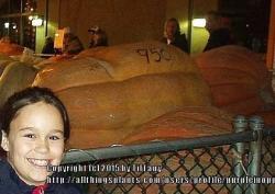
Vicki, yes, the pumpkin festival is so awesome! Here's a 950-pound'er, 2004 I think.