Today's update from Crown Weather service
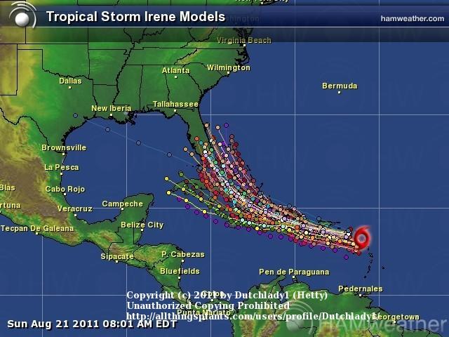
The GFS ensemble model forecasts that this disturbance will track into the northeastern Caribbean on Sunday and then across Puerto Rico and the eastern tip of Hispaniola Sunday night into Monday. The GFS ensemble guidance then forecasts this system to track west-northwestward across the southern Bahamas during Tuesday and Wednesday of next week and then into the Florida Straits next Thursday before turning northwestward into the eastern Gulf of Mexico next Friday into next Saturday. Ultimately, the GFS ensemble guidance forecasts this disturbance to make landfall on the Florida Panhandle right around Monday, August 29.
The European model ensemble guidance forecasts a track that also takes this system across the northeastern part of the Caribbean this weekend and across Puerto Rico around Monday. The European ensemble guidance then is very close to its operational counterpart in forecasting this system to track across the Bahamas during the middle part of next week. At the 10 day mark, the ensemble guidance is different than the operational guidance in that the ensembles are forecasting this system to be located just east of Cape Canaveral, Florida while the operational guidance is forecasting landfall very near Savannah, Georgia.
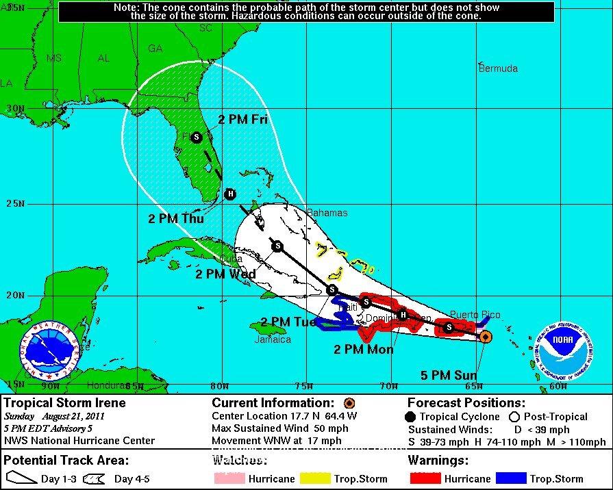
It is both notable and worrisome that the model guidance are very consistent in their forecasts of a landfall somewhere between the Florida Panhandle and coasts of North and South Carolina. I do want to caution you though that these model guidance forecasts could turn out to be wrong. Satellite imagery this morning showed plenty of dry air that is capping off any real convection and the robust development is not forecast for at least another 4 to 5 days and the models should not be trusted with their intensity forecasts that far out